
GIS Services
At PITCO, we specialize in providing GIS support for public and private sector operators. We specialize in the acquisition, analysis, and production of spatial data. Our clients range from government, NGOs, public to private sectors and they employ our expertise to acquire and analyze their geographic information. Our knowledge of surveying, geo-referencing, data manipulation and GIS structure and development ensures high quality output of digital raster images or computer-aided drafting and geographically-oriented vector data for GIS software application. Our GIS projects are proof of our successful technology application into the solutions of real world problems. Understanding the needs of our clients combined with leveraging the significant recent advances in technology brings a great value to anyone looking to employ our GIS services.
Consulting Services
- GIS and database automation
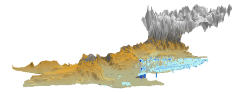
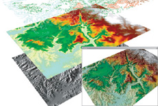
- 3D and spatial modelling
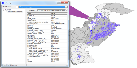
- Field Surveys / GPS data collection and processing
- Advanced image analysis
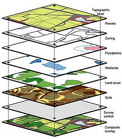
- Geo-database design
- Data mining
- Visual / photo simulations
- GPS / field deployment
- Cartography / map template design
- GIS / CAD integration
- Web-based GIS/Mapping
- Arc-GIS Customization
- GIS Desktop Application Development
- GIS data format conversion to engineering analysis software
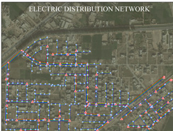
Utilities
- Smart Grid
- Asset management
- Outage management
- Workforce automation
- Renewable energy
- Regulatory compliance
- Joint Use
- Field Maintenance and Inspection
- Transmission Network Design
- Generation Site Selection
- Licensing
- Environmental Analysis
Water and Wastewater
- Groundwater Modelling
- Distribution, collection, and drainage networks tracking
- Planning and development
- Spatial analysis
- Water-related monitoring and modelling
Environmental Management
- Renewable Energy
- Resource potential forecasting
- Existing and required infrastructure modeling
Surveying
- Infrastructure Development
- Project Planning
- Data Collection
- Predesign and Design Analysis
- Construction
- Land Development
- Survey Data Management
- Facilities Management